Федеральное государственное бюджетное учреждение науки
Геологический институт им. Н.Л. Добрецова
Сибирского Отделения Российской академии наук
(ГИН СО РАН)
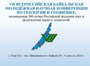
Мир Бурятия "Гравитация науки: Геологический институт БНЦ СО РАН"
Дайджест мировых новостей:
Mount St. Helens 30th Anniversary [2010-05-14] Vancouver, Wash. mdash; On Sunday, May 18, 1980 at 8:32 a.m., the bulging north flank of Mount St. Helens slid away in a massive landslide -- the largest in recorded history. nbsp; Seconds later, the uncorked volcano exploded and blasted rocks northward across forest ridges and valleys, destroying everything in its path within minutes.
Nine hours of explosive volcanic activity ensued, altering the landscape, and what we know about volcanoes, forever.
On Sunday, May 18, 1980 at 8:32 a.m., the bulging north flank of Mount St. Helens slid away in a massive landslide -- the largest in recorded history. nbsp; Seconds later, the uncorked volcano exploded and blasted rocks northward across forest ridges and valleys, destroying everything in its path within minutes. nbsp;
The opening minutes of the eruption claimed the lives of 57 people. nbsp; Prevailing winds carried 520 million tons of ash eastward across the United States, producing darkness during daylight hours in Spokane, more than 250 miles away, and other communities is its path. nbsp; Water from melting snow and ice mixed with loose rock debris to form lahars ndash; volcanic mudflows ndash; that poured down river valleys ripping trees from their roots and engulfing roads, bridges and houses.
Thirty years later, excess sediment is still moving down those river drainages most affected by erupted debris on May 18, impressing upon all that hazards can persist long after an eruption is over. The eruption left an indelible effect on the regional economy and lives of citizens in the Pacific Northwest and beyond. nbsp; nbsp; nbsp; nbsp; nbsp;
ldquo;The spectacular nature of the May 18, 1980 eruption is one of those unforgettable time markers for anyone who lived through the effects of the eruption or saw the images through the media, rdquo; said Carolyn Driedger, hydrologist and outreach specialists at the Cascades Volcano Observatory. nbsp; ldquo;Thirty years later, people still want to tell you where they were and what they experienced when Mount St. Helens blew. nbsp; In the Pacific Northwest and around the world, people awoke to the idea of what it meant to live near an active volcano. rdquo;
The eruption of Mount St. Helens -- the most destructive eruption in U.S. history -- was the first large explosive eruption in the United States since the advent of modern volcanology. nbsp; It was a catalyst for an era of unprecedented scientific discovery, monitoring development and community awareness.
The volcano instantly became, and remains, a volcanologist rsquo;s ideal laboratory. nbsp; Its accessibility has allowed scientists to return to the volcano over and over again to examine new deposits before they eroded away, to test new concepts about how volcanoes work, and to try out new tools. The landslide exposed the inside the mountain affording scientists with an unprecedented opportunity to inspect a volcano rsquo;s interior, and learn about its history from the inside out. nbsp; nbsp; Frequent eruptions have helped scientists draw correlations between monitoring signals and impending eruptions. nbsp; nbsp;
Two short videos, Mount St. Helens: May 18, 1980, and Mount St. Helens: Catalyst for Change, show footage of the eruption and encapsulate USGS scientists rsquo; recollections of the event and some of the changes in volcano monitoring since then. nbsp; They are also available on YouTube at http://www.youtube.com/user/usgs#p/a/u/2/Ec30uU0G56U and http://www.youtube.com/user/usgs-p/a/u/1/sC9JnuDuBsU.
The United States and its territories contain 169 volcanoes considered capable of erupting, but prior to the Mount St. Helens eruption the only U.S. Geological Survey volcano observatory was in Hawaii. The May 1980 eruption, however, would be the catalyst for change, as increased money would be allocated for volcano science and monitoring and in 1982 the Cascades Volcano Observatory (CVO) was founded to provide timely warning about volcanic unrest and eruption throughout the Cascades. nbsp;
Since that time, additional volcanic events and better recognition of areas of interest have resulted in the growth of USGS rsquo; Volcano Hazards Program. Today, the USGS has five volcano observatories: Cascades Volcano Observatory in Washington; the Hawaiian Volcano Observatory; the Long Valley Observatory in California; the Yellowstone Observatory; and the Alaska Volcano Observatory. nbsp;It also hosts an international response unit called the Volcano Disaster Assistance Program (VDAP), which helps other countries respond to volcanic unrest within their borders.
The eruption showed the importance of having a robust monitoring system on a volcano before an eruption occurs. Scientists who worked at Mount St. Helens have taken their measurement equipment to restless volcanoes around the world.
ldquo;Since the numerous eruptions of Mount St. Helens in the 1980s, volcano monitoring has come a long way, rdquo; said Seth Moran, an earthquake specialist at CVO. nbsp; ldquo;In many locations, we rsquo;ve essentially gone from having a few instruments placed on a volcano rsquo;s flanks to having a broad network of earthquake and deformation monitoring devices feeding us information 24/7. While we rsquo;re not able to do this on every volcano, where we can, these instruments have given volcanologists unprecedented access to what rsquo;s really happening on a volcano, and help greatly in predicting the nature of future activity. rdquo;
Today scientists rely not only on instruments on the ground, but also aerial surveys of volcanic gases and satellite data from space.
The reawakening of Mount St. Helens after being dormant for 123 years did more than increase interest in volcano science and monitoring, it also pointed out the need for improvement in how scientists, emergency managers and communities, plan for these events. nbsp;
Today the USGS, the Pacific Northwest Seismic Network at the University of Washington, emergency managers and community leaders in potentially affected communities work together developing and refining monitoring, notification systems and response planning. nbsp; Community education and outreach programs have been developed to help people prepare for potential eruptions. nbsp; Together these partnerships and their efforts in the Northwest, as well as similar partnerships in other areas around the country, have raised awareness and readiness in areas most likely to be impacted by a volcano.
nbsp; ldquo;Since 1980, we rsquo;ve learned how important it is for scientists, public officials and communities to be prepared for an eruption long before the actual event. nbsp; Proper preparations include sufficient monitoring of the volcano, notification systems, response planning, and community education and preparation rdquo;, said Cynthia Gardner, Scientist-in-Charge at CVO.
ldquo;With hundreds of scientists visiting Mount St. Helens, a whole new generation of volcanologists was born, rdquo; Gardner added. nbsp; ldquo;Since 1980, hundreds of scientists have visited Mount St. Helens. nbsp; Many of these scientists have made geological and biological studies of other volcanoes in the U.S. and its territories; others returned to volcanic homelands across the globe to apply their new knowledge. rdquo;
ldquo;For a volcano whose name generally was unknown outside the Pacific Northwest before 1980, Mount St. Helens has given us a far-reaching and invaluable legacy. rdquo;
For more information on this event or others, or for information on Cascades Volcano Observatory, go to http://vulcan.wr.usgs.gov/
Вы ощущали землетрясение?
Просим Вас заполнить анкету Анкета
Основные научные направления
•
Эволюция тектонических структур, магматизма и рудообразования в различных геодинамических обстановках складчатых поясов;
•
Геоэкология Байкальского региона
Диссертационный совет Д 003.002.01.
К защите принимаются диссертации на соискание ученой степени кандидата и доктора наук по специальностям: 25.00.04 - петрология, вулканология; 25.00.11 - геология, поиски и разведка твердых полезных ископаемых, минерагения
Действует аспирантура по направлению наук 05.06.01 Науки о Земле по следующим специальностям: