Федеральное государственное бюджетное учреждение науки
Геологический институт им. Н.Л. Добрецова
Сибирского Отделения Российской академии наук
(ГИН СО РАН)
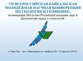
Мир Бурятия "Гравитация науки: Геологический институт БНЦ СО РАН"
Дайджест мировых новостей:
President's 2012 USGS Budget Proposal [2011-02-14] The President rsquo;s proposed $1.1 billion budget for the U.S. Geological Survey in 2012 emphasizes cost-containment and program savings while investing in research and development programs to restore and protect the nation rsquo;s lands and waters for future generations.
ldquo;The USGS supports Secretary Salazar rsquo;s and the Administration rsquo;s strong commitment to use science as the cornerstone of natural resource management by providing timely, unbiased research related to our nation rsquo;s most important natural resources, rdquo; said Marcia McNutt, USGS Director. ldquo;By providing funds for the sustained operation of Earth-observing satellites and for scientific research to enable understanding of complex ecosystems, the USGS budget will help our nation meet its energy needs, protect its land, water and wildlife, and make wise decisions about natural resources. rdquo;
The 2012 budget represents an increase of $6.1 million from the 2010 enacted level, which includes net program increases of $28.8 million, administrative cost savings of $23.4 million, and fixed costs and related change increases of $710,000.
To address the President rsquo;s priority on fiscal responsibility, the USGS 2012 budget makes vital investments in research and development and ecosystem restoration, while also finding difficult reductions within programs such as regional assessments of groundwater quantity and quality, toxic substances research on the nation rsquo;s waters, mineral resource assessments, research and grants to improve the nation rsquo;s resilience to natural hazards, the Water Resources Research Act program, the National Biological Information Infrastructure, the National Geological and Geophysical Data Preservation program, the National Cooperative Geological Mapping program, research to establish the limits of the extended outer continental shelf, and the climate effects network. These changes reflect tough choices and repositioning of core responsibilities to better address complex multidisciplinary issues.
Proposed USGS key program increases are summarized below. More detailed information on the President rsquo;s proposed budget is available on the USGS FY2012 Budget and Related Information website.
National Land Imaging nbsp; nbsp; nbsp; nbsp; nbsp; nbsp; nbsp; nbsp; nbsp; nbsp; nbsp; nbsp; nbsp; nbsp; nbsp; nbsp; nbsp; nbsp; nbsp; nbsp; nbsp; nbsp; nbsp; nbsp; nbsp; nbsp; nbsp; nbsp; nbsp; nbsp; nbsp; nbsp; nbsp; nbsp; nbsp; nbsp; nbsp; nbsp; nbsp; nbsp; nbsp; nbsp; nbsp; nbsp; nbsp; nbsp; nbsp; nbsp; nbsp; nbsp; nbsp; nbsp; nbsp; nbsp; nbsp; nbsp; nbsp; nbsp; nbsp; nbsp; nbsp; nbsp; nbsp; nbsp; nbsp; nbsp; nbsp; nbsp; nbsp; nbsp; nbsp; nbsp; nbsp; nbsp; nbsp; nbsp; nbsp; nbsp; nbsp; nbsp; nbsp; nbsp; nbsp; nbsp; nbsp; nbsp; nbsp; nbsp; nbsp; nbsp; nbsp; nbsp; nbsp; +$48.0 million
A new account is proposed for Landsat missions. Landsat furthers the Department of the Interior rsquo;s important role in land and remote sensing under the President rsquo;s National Space Policy and provides invaluable data for land use and climate change research. The new account will include funding for current satellites (Landsats 5 and 7); the Landsat Data Continuity Mission (Landsat 8), which is scheduled to launch in December 2012; and the development of Landsats 9 and 10, through a continuous Landsat program that will ensure data continuity in the future.
ldquo;There is no commercial replacement for the breadth and depth of data collected by Landsat satellites, which are then used in a multitude of ways by the agricultural, water management, disaster response, and scientific communities, rdquo; said Director McNutt. ldquo;Because Landsat enables us to see Earth rsquo;s surface so clearly, so broadly, so objectively, we gain invaluable insights about the complexity of Earth systems and the condition of our natural resources. rdquo;
Ecosystem Restoration nbsp; nbsp; nbsp; nbsp; nbsp; nbsp; nbsp; nbsp; nbsp; nbsp; nbsp; nbsp; nbsp; nbsp; nbsp; nbsp; nbsp; nbsp; nbsp; nbsp; nbsp; nbsp; nbsp; nbsp; nbsp; nbsp; nbsp; nbsp; nbsp; nbsp; nbsp; nbsp; nbsp; nbsp; nbsp; nbsp; nbsp; nbsp; nbsp; nbsp; nbsp; nbsp; nbsp; nbsp; nbsp; nbsp; nbsp; nbsp; nbsp; nbsp; nbsp; nbsp; nbsp; nbsp; nbsp; nbsp; nbsp; nbsp; nbsp; nbsp; nbsp; nbsp; nbsp; nbsp; nbsp; nbsp; nbsp; nbsp; nbsp; nbsp; nbsp; nbsp; nbsp; nbsp; nbsp; nbsp; nbsp; nbsp; nbsp; nbsp; nbsp; nbsp; nbsp; nbsp; nbsp; nbsp; nbsp; nbsp; nbsp; nbsp; nbsp; nbsp; nbsp; nbsp; nbsp;+$12.0 million
America rsquo;s Great Outdoors is the President rsquo;s signature conservation initiative. The goal of the initiative is to protect and restore the health, heritage, natural resources, and social and economic value of some of the nation rsquo;s most significant ecosystems. The USGS plays a vital role in the development and implementation of the America rsquo;s Great Outdoors initiative, working in collaboration with other Department of the Interior bureaus and Federal agencies. Particular focus is given to the important and iconic ecosystems, with targeted increases for the Chesapeake Bay (+$4.6 million), Great Lakes (+$3.5 million), Columbia River (+$1.4 million), Upper Mississippi River (+$1.0 million) and Puget Sound (+1.5 million). This includes the USGS rsquo; role in the Asian Carp Control Framework to detect and understand this invasive fish and develop chemical control tools.
DOI Climate Science Centers nbsp; nbsp; nbsp; nbsp; nbsp; nbsp; nbsp; nbsp; nbsp; nbsp; nbsp; nbsp; nbsp; nbsp; nbsp; nbsp; nbsp; nbsp; nbsp; nbsp; nbsp; nbsp; nbsp; nbsp; nbsp; nbsp; nbsp; nbsp; nbsp; nbsp; nbsp; nbsp; nbsp; nbsp; nbsp; nbsp; nbsp; nbsp; nbsp; nbsp; nbsp; nbsp; nbsp; nbsp; nbsp; nbsp; nbsp; nbsp; nbsp; nbsp; nbsp; nbsp; nbsp; nbsp; nbsp; nbsp; nbsp; nbsp; nbsp; nbsp; nbsp; nbsp; nbsp; nbsp; nbsp; nbsp; nbsp; nbsp; nbsp; nbsp; nbsp; nbsp; nbsp; nbsp; nbsp; nbsp; nbsp; nbsp; nbsp; nbsp; nbsp; nbsp; nbsp; nbsp; nbsp; +$11.0 million
The USGS will complete the network of Department of the Interior Climate Science Centers, as called for in Secretarial Order 3289. The planned network of eight DOI Climate Science Centers will provide fundamental science and tools to landscape conservation cooperatives and to national and cultural resource managers. The centers focus on understanding landscape stressors related to climate change and designing adaptation strategies at a regional level. At the proposed funding level, the Northeast, South Central, and Pacific Islands Climate Science Centers will be established.
Coastal and Marine Spatial Planning nbsp; nbsp; nbsp; nbsp; nbsp; nbsp; nbsp; nbsp; nbsp; nbsp; nbsp; nbsp; nbsp; nbsp; nbsp; nbsp; nbsp; nbsp; nbsp; nbsp; nbsp; nbsp; nbsp; nbsp; nbsp; nbsp; nbsp; nbsp; nbsp; nbsp; nbsp; nbsp; nbsp; nbsp; nbsp; nbsp; nbsp; nbsp; nbsp; nbsp; nbsp; nbsp; nbsp; nbsp; nbsp; nbsp; nbsp; nbsp; nbsp; nbsp; nbsp; nbsp; nbsp; nbsp; nbsp; nbsp; nbsp; nbsp; nbsp; nbsp; nbsp; nbsp; nbsp; nbsp; nbsp; nbsp; nbsp; nbsp; nbsp; nbsp; nbsp; nbsp; nbsp; nbsp; nbsp; nbsp; nbsp; nbsp; +$4.5 million
The Department of the Interior has substantial coastal and ocean resource management responsibilities and a critical role in implementing the Administration's National Ocean Policy. The USGS will continue leading the development of a national information management system for coastal, oceanic and Great Lake resources. This involves conducting a number of efforts important in managing resources with other Federal, State, tribal, and regional partners. Efforts include constructing a prototype Coastal and Marine Spatial Planning Internet portal for the Gulf of Mexico, developing modeling tools to forecast coastal vulnerability to projected sea level rise and predicted coastal storms, and establishing data standards and undertaking gap analysis to target future priority data collection activities.
Вы ощущали землетрясение?
Просим Вас заполнить анкету Анкета
Основные научные направления
•
Эволюция тектонических структур, магматизма и рудообразования в различных геодинамических обстановках складчатых поясов;
•
Геоэкология Байкальского региона
Диссертационный совет Д 003.002.01.
К защите принимаются диссертации на соискание ученой степени кандидата и доктора наук по специальностям: 25.00.04 - петрология, вулканология; 25.00.11 - геология, поиски и разведка твердых полезных ископаемых, минерагения
Действует аспирантура по направлению наук 05.06.01 Науки о Земле по следующим специальностям: